Bay Area & Central Sea

Ursula LeGuin did it first–Always Coming Home has a fantastic drawing of this, created in the mid-1980s.

This map shows what central California and the Bay Area will look like when the ice caps completely melt–66m of sea level rise.

The poster is available at Zazzle.

CentralValleyForWeb20150802Burrito Justice did a San Francisco version a few years ago. His map inspired much of the work I’ve done wigh sea rise maps in the past couple of years.

My favorite landforms? Sutter Island and the Isle near Rio Vista. Marin also becomes an island, which makes sense in many ways. Sacramento? Stockton? Lodi? Manteca? Screwed. The historic Tulare Lake re-emerges, but with salt water this time around. Monterey Bay becomes much larger.


Los Angeles, 1928

This one’s for all my LA folks…

One of the things about being between jobs is that you get to find little projects to obsess over. I’ve been enjoying combing through old archives, finding these cool old maps, and restoring them (while still  maintaining the vintage patina). This 1928 map of downtown Los Angeles was torn, stamped and stained when I found it.

Los Angeles at this time had one of the most extensive streetcar networks in the world. There were no freeways in LA in 1928. There were very few anywhere–the first proto-autobahn was built in Germany in 1922. If you look at this area now, there are freeways in every direction. Here’s the modern view.

Order full-sized prints, or wrapped canvas maps here…

1928 Map of Los Angeles--Archival Paper Print
1928 Map of Los Angeles–Archival Paper Print
1928 Map of Los Angeles--Wrapped Canvas
1928 Map of Los Angeles–Wrapped Canvas


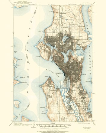
City of Seattle, 1908


Seattle, 1908

Every once in a while, here at Spatialities world headquarters, our research department (me) runs into an old archived map that our marketing department (also me) thinks would look great on someone’s wall.

I found this 1908 USGS quad while researching the former location of the Lake Washington shoreline. It’s from an important time in Seattle’s history. The the Alaska Yukon Pacific Exposition was about to happen, which would shape the University of Washington campus for the next century and beyond. Because the Ship Canal had not been built, Lake Washington was eight feet higher.  The Duwamish River still meandered, and South Park and Georgetown were towns in their own right. People were still waiting for the interurban. Rail travel within and between cities was still the best way to get around. Freeways hadn’t been invented.

I did a considerable amount of clean-up to this map–removing old rubber-stamps and imperfections.  It’s now ready for your wall.

You can order hard-copy prints of the files I’ve cleaned up here…

1908 Map of Seattle--Archival Paper Print
1908 Map of Seattle–Archival Paper Print
1908 Map of Seattle--Wrapped Canvas
1908 Map of Seattle–Wrapped Canvas


Continue reading